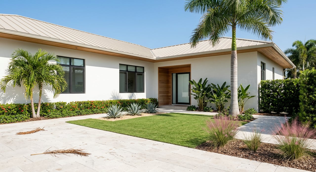
Boat-Friendly Homes on Longboat Key for Avid Boaters
Dreaming of stepping from your back door onto your boat and cruising the turquoise water around Longboat Key? Choosing the right waterfront home takes more than a pretty view. Depth, bridges, canal width, and permits determine what you can safely operate from your dock. This guide walks you through the essentials, from navigation and permitting to flood and insurance, with a practical checklist you can use on any showing. Let’s dive in.
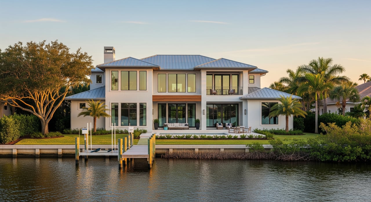
How you boat should shape the property you buy. If you love quick Gulf day trips for fishing or sunset runs, you will value shorter routes to a Gulf pass. If your plans lean toward bay cruising, visiting islands, or inshore fishing, sheltered back‑bay access and shorter run times matter most. Larger vessels need deeper channels, wider canals, and higher bridge clearance.
Longboat Key is a barrier island between the Gulf of Mexico and Sarasota Bay, and it spans both Manatee and Sarasota counties. That means bridge clearances, canal maintenance, and permitting can change along your route. Clarify your boating style first, then match the property’s water access to your needs.
Constricted canals make it hard to turn, dock, or pass other vessels. They also reduce the usable space along a dock.
What to record:
Practical tip: Larger boats between 30 and 50 feet need significantly more turning radius. If you are unsure, bring in a local captain for a trial approach.
Depth at low tide determines under‑keel safety and how often you can leave the dock. Many local channels shoal and change seasonally.
What to record:
Practical tip: Always verify against MLLW/MLW on the chart and confirm with a site visit at a lower tide.
A low fixed bridge or power lines can block sailboats and taller cabin boats.
What to record:
Practical tip: Map the full water route to the Gulf and list each bridge’s stated clearance plus tidal swing. Confirm your intended vessel’s air draft at its highest points.
Distance and route complexity affect fuel, time, and how often you actually go. If frequent Gulf outings are your plan, being closer to a pass can reduce transit time. If you prefer protected water, bay access near flats and islands may outweigh being closest to the Gulf.
What to record:
Strong currents at passes and shifting sandbars can change plans fast.
What to record:
Practical tip: Run the route at both mid and lower tides before you commit.
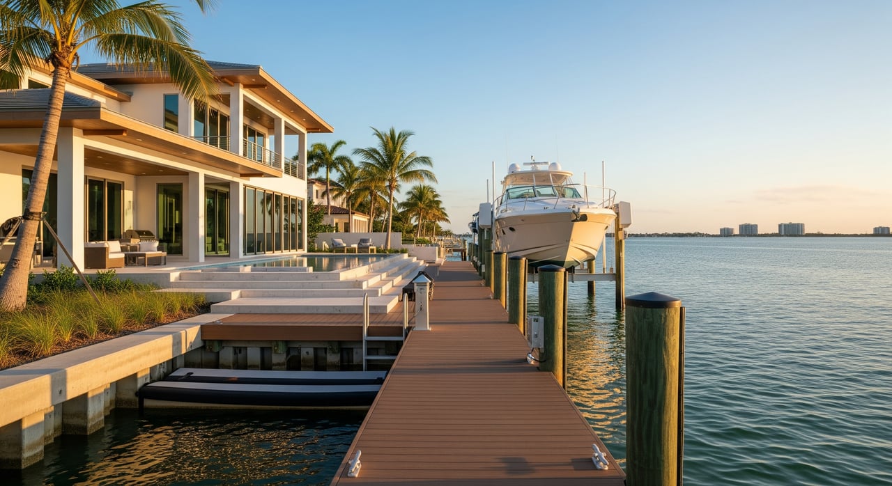
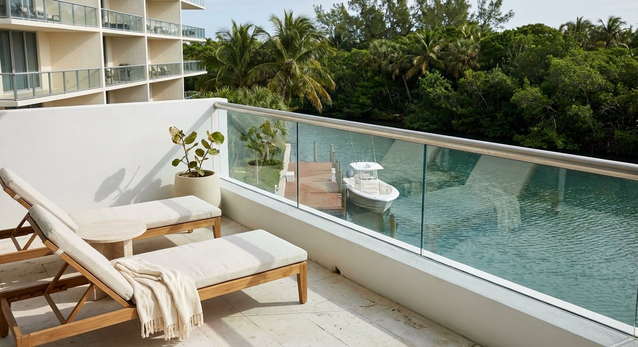
A beautiful deck does not guarantee a sound seawall or a safe lift.
Structures over submerged lands often require authorization. In Florida, the Florida Department of Environmental Protection oversees many submerged lands and dock permits, and the U.S. Army Corps of Engineers, Jacksonville District may regulate work in navigable waters. Confirm whether riparian rights convey with the property and whether any shared accesses or restrictions exist. Many Longboat Key HOAs also set limits on boat size, number of slips, and allowed structures.
Ask who maintains the channel and at what depth. It may be the county, an HOA, a special assessment district, or individual owners. Request records of past dredging, permits, and costs. Private responsibility can be material, so treat it like a future capital expense.
Many waterfront parcels on Longboat Key sit in higher‑risk flood zones, which can trigger lender requirements.
Manatee protection zones and seagrass areas shape speed limits and where you can place and use dock structures. Review boating rules with the Florida Fish and Wildlife Conservation Commission, and expect additional scrutiny or mitigation if seagrass beds are present near your dock footprint.
Confirm available shore power and water at the dock and whether the home is on public sewer. Note distance to the nearest fuel and pump‑out, and where you would go for a haulout if needed.
A private dock gives immediate access and lifestyle convenience, but it comes with maintenance, permitting, and potential dredging responsibilities. Marinas offer storm security, services, and predictable costs, though you will travel from home to your boat.
Questions to weigh:
A simple comparison of annual marina costs versus projected dock and seawall upkeep can clarify the best path.
Have a plan before you buy. Identify where you will haul, whether local marinas accept outside boats during storms, and how you will secure lines and remove canvases and electronics. High‑wind‑rated lifts and sheltered moorings help, but hauling to dry storage or moving inland to protected waters may be your safest option in major storms.
Physical and navigation
Property and legal
Dock and infrastructure
A boat‑friendly home on Longboat Key should support how you actually plan to boat, not just how the view looks on a sunny afternoon. When you verify depth, bridge clearance, canal width, permits, and flood risk up front, you avoid costly surprises and set yourself up for easy, frequent days on the water. If you prefer a concierge approach, I can help coordinate charts, permits, inspections, and trial runs tailored to your vessel and lifestyle.
If you are ready to explore boat‑friendly homes on Longboat Key, reach out to Juli Pearce for discreet, data‑driven guidance that puts your boating plans first. Let’s connect.

Let Julianne guide you through Sarasota’s luxury real estate market with the expertise, insight, and personalized attention you deserve. From beachfront estates to serene golf course homes, your ideal Florida lifestyle is just a phone call away.